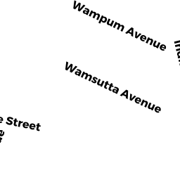
25 WAMSUTTA AVE
Owner Information
MCWHINNIE, DORIS
25 WAMSUTTA AVE.
WALTHAM, MA 02451-3228


Property Details
25 WAMSUTTA AVE is classified as a Single Family Residential (Old style).
The primary structure on this property was built in 1920. There are 842ft2 of built area within this property. There is 842ft2 of residential/living space within this property. This property is listed as having 4 rooms.
25 WAMSUTTA AVE is valued at $422,200. The land is valued at $258,400 and the structures are valued at $161,000. There is an additional valuation of $2,800 on this property.
The most recent deed for 25 WAMSUTTA AVE is recorded at the local registrar in Book 46588, Page 536-53. 25 WAMSUTTA AVE was last sold on Thursday, December 1, 2005 for $300,000.
Assessment data from fiscal year 2022.
Flood Data
According to the FEMA National Flood Hazard Layer, this property does not appear to be in a flood zone. It may also be in an area not yet reviewed. Nonetheless, confirm this information prior to taking any action.
To view the flood hazards around this property, create a FEMA "Firmette" Map of the area around 25 WAMSUTTA AVE.
Broadband Internet Providers
| Provider | Type | Bandwidth (mbps) | |
|---|---|---|---|
| GCI Communication Corp. | Satellite | 0 | 0 |
| HughesNet | Satellite | 25 | 3 |
| VSAT Systems, LLC. | Satellite | 2 | 1 |
| Viasat Inc | Satellite | 100 | 3 |
| Verizon New England Inc. | Fiber | 940 | 880 |
| Comcast | Cable | 1000 | 35 |
| RCN | Cable | 500 | 20 |
| RCN | Cable | 1000 | 20 |
Broadband service provider data from December 2020.
Adjacent Properties
- 29 WAMSUTTA AVE
Single Family Residential owned by BUCZYNSKI, KURTIS A. & NICOLE - 23 WAMSUTTA AVE
Single Family Residential owned by GARTLAND, JOHN JOSEPH JR & - 8 WAMPUM AVE
Single Family Residential owned by GOLDEN, KENNETH D. - 12 WAMPUM AVE
Single Family Residential owned by MARTIN, ROBERT M. & - 16 WAMPUM AVE
Single Family Residential owned by PRIEZ, CHRISTINE & SYLVIE